
Report and Disseminate the Information Regarding
the Serious Disaster
Monsoonal Flooding in Myanmar
August 2021
Source: The Department of Meteorology and Hydrology (DMH) of Myanmar,
the Department of Disaster Management (DDM) of Myanmar, and Ministry of Agriculture, Livestock and Irrigation of Myanmar
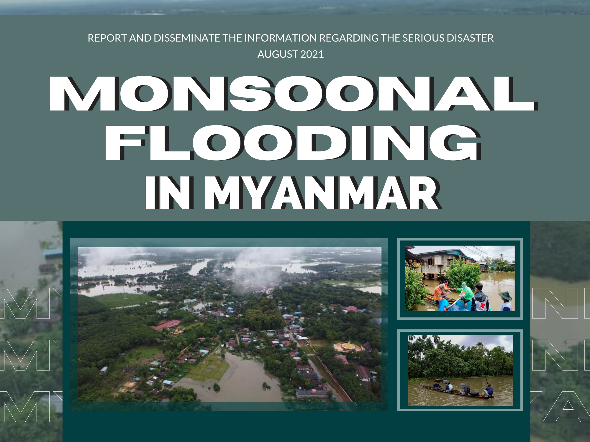
The prolonged heavy rainfall occurred in Myanmar across Rakhine, Bago, Ayeyarwady, Kayin, Mon, and Tanitharyi states with maximum rainfall per day around 50 millimetres during 21-26 July 2021. This prolonged heavy rain has caused flooding in Karen State, Mon State, and Tanintharyi Region since 22 July 2021. In addition, on 27 July 2021, the Department of Meteorology and Hydrology (DMH) of Myanmar reported that the low pressure area over the North Bay of Bengal still persists. Monsoon is vigorously strong over the Andaman Sea and Bay of Bengal. While, the Department of Disaster Management (DDM) of Myanmar has released a flood warning for Salween and Thaung River in Kayin State (Hpa, Bilin, and Myawaddy) and Sittaung River in Bago (Madawk) as of 27 July 2021.
A total of 48,472 persons have been evacuated/affected in the Kayin, Mon, and Rakhine states. In Kayin State, 681 households or 3,016 persons (1,429 males and 1,587 females) evacuated/affected and 2,104 households or 11,903 persons (5,735 males and 6,168 females) preemptively evacuated into 16 evacuation centres. In Mon State, 4,462 households or 19,840 persons (304 males and 349 females identified) evacuated/affected, and 3,335 households or 10,770 persons (4,885 males and 5,885 females) preemptively evacuated into 8 evacuation centres. In Rakhine State – 1,712 households or 25,799 persons (1,733 males and 1,936 females) evacuated/affected.
Regarding to the report from the Ministry of Agriculture, Livestock and Irrigation of Myanmar, the monsoonal flooding in July 2021 caused some damages to crops which are paddy (rainy season) and maize (rainy season). The damage area of paddy is 299 hectares, and the damage area of maize is 5 hectares, and there is no damage area of the rest of five main crops which are soybean, sugarcane, and cassava.
Download word file click here --> AFSIS Monsoonal Flooding in Myanmar

The AFSIS Secretariat participated in the 10th International Conference on Agricultural Statistics (ICAS X), held from 8 to 10 July 2026 at the ICE Krakow Congress Centre in Krakow, Poland. Jointly organized by Statistics Poland, Eurostat, the United States Department of Agriculture (USDA), the World Bank Group, and the Food and Agriculture Organization of the United Nations (FAO).
.JPG)
On 24–25 June 2026, AFSIS Secretariat participated in the 46th Meeting of the ASEAN Food Security Reserve Board (AFSRB) via a virtual conference. The Meeting was jointly organized by the AFSRB Secretariat and the Department of Agriculture (DOA), Ministry of Agriculture, Livestock and Irrigation (MOALI) of the Republic of the Union of Myanmar, and was hosted in Nay Pyi Taw, Myanmar.

On 17–18 June 2026, the 24th AFSIS Focal Point Meeting was successfully convened via video conference, hosted by the Philippine Statistics Authority (PSA) in collaboration with the ASEAN Food Security Information System (AFSIS) Secretariat.
.jpg)
The ASEAN Food Security Information System (AFSIS) Secretariat, in collaboration with the Ministry of Agriculture, Forestry and Fisheries (MAFF) Japan, Japan Aerospace Exploration Agency (JAXA), Remote Sensing Technology Center of Japan (RESTEC), and Geo-Informatics and Space Technology Development Agency (GISTDA), conducted the 2nd Hands-on Training Courses for Agricultural Statisticians, the Final Workshop, and the 2nd Seminar for Executive Officials under the JAIF Project entitled “Improvement of Rice Paddy Area Statistics and Damage Assessment using Earth Observation Satellites for ASEAN” in Sriracha, Chonburi Province, and Bangkok, Thailand.

