Report and Disseminate the Information Regarding
the Serious Disaster
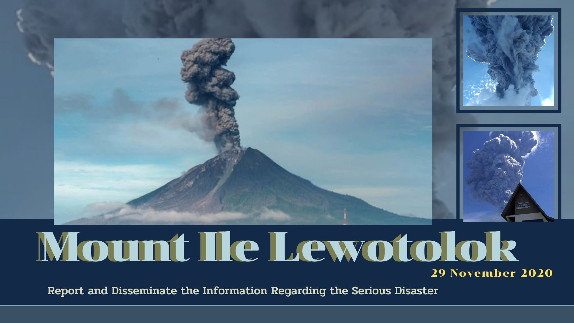
Eruption of Mount Ile Lewotolok, Indonesia
November 2020
Source: Ministry of Agriculture, Indonesia
On November 29, 2020, there was an eruption of Mount Ile Lewotolok or Mount Ile Ape, in Lembata District at East Nusa Tenggara Province in Indonesia. The affected areas which are 17 villages in Ile Ape Sub-District and 9 villages in East Ile Ape Sub-District were expected to be damaged from this eruption. More than 2,700 people from these 26 villages were evacuated to the safe zone.
The impact of the eruption has not affected the whole picture of Indonesia crop production because Ile Ape Sub-District and East Ile Ape Sub-District are not Indonesian main crop producer for rice and maize. Regarding the eruption, 18 hectares or approximately 34.27 tonnes of upland rice and 5 hectares or approximately 9.61 tonnes of maize in Ile Ape Sub-District were damaged. In addition, 15 hectares or approximately 28.56 tonnes of the upland rice and 2 hectares or approximately 3.84 tonnes of the maize in East Ile Ape Sub-District were also damaged. This total damaged area is not much compared to the national crop production area. Therefore, the total damaged area from the eruption of Mount Ile Lewotolok was not had a significant impact on national food supply as a whole in Indonesia.
In this regard, Indonesia government mainly provided assistances in term of food, medicine and shelter posts for the refugees. Moreover, there were food assistance from districts nearby to support two damaged sub-districts. While there is still no help from other countries’ governments. However, the future effect is many plantation/lands will be abandoned or late in planting, which will cause a decrease in productivity and impact on food security in these two districts. The Indonesian local government and volunteers will help farmers to re-cultivate crops.
Word File: Eruption of Mt Ile Lewotolok in Indonesia

The AFSIS Secretariat participated in the 10th International Conference on Agricultural Statistics (ICAS X), held from 8 to 10 July 2026 at the ICE Krakow Congress Centre in Krakow, Poland. Jointly organized by Statistics Poland, Eurostat, the United States Department of Agriculture (USDA), the World Bank Group, and the Food and Agriculture Organization of the United Nations (FAO).
.JPG)
On 24–25 June 2026, AFSIS Secretariat participated in the 46th Meeting of the ASEAN Food Security Reserve Board (AFSRB) via a virtual conference. The Meeting was jointly organized by the AFSRB Secretariat and the Department of Agriculture (DOA), Ministry of Agriculture, Livestock and Irrigation (MOALI) of the Republic of the Union of Myanmar, and was hosted in Nay Pyi Taw, Myanmar.

On 17–18 June 2026, the 24th AFSIS Focal Point Meeting was successfully convened via video conference, hosted by the Philippine Statistics Authority (PSA) in collaboration with the ASEAN Food Security Information System (AFSIS) Secretariat.
.jpg)
The ASEAN Food Security Information System (AFSIS) Secretariat, in collaboration with the Ministry of Agriculture, Forestry and Fisheries (MAFF) Japan, Japan Aerospace Exploration Agency (JAXA), Remote Sensing Technology Center of Japan (RESTEC), and Geo-Informatics and Space Technology Development Agency (GISTDA), conducted the 2nd Hands-on Training Courses for Agricultural Statisticians, the Final Workshop, and the 2nd Seminar for Executive Officials under the JAIF Project entitled “Improvement of Rice Paddy Area Statistics and Damage Assessment using Earth Observation Satellites for ASEAN” in Sriracha, Chonburi Province, and Bangkok, Thailand.

